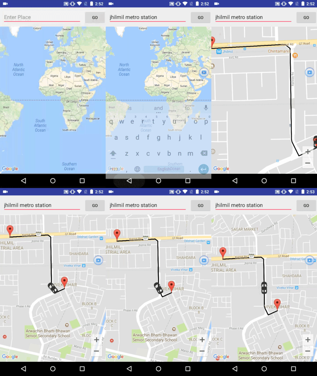
A demo application which demonstrates movement of car on map developed after inspiration from Uber.
Youtube Link: https://www.youtube.com/watch?v=JIs4kLZ8qQI
APIs and Libraries used
- Google Maps Api
- Google Maps Directions API
- Volley
Steps:
- Parse the "overview_polyline" from the JSON by providing the appropriate GET parameters. For eg:
"https://maps.googleapis.com/maps/api/directions/json?" + "mode=driving&" + "transit_routing_preference=less_driving&" + "origin=" + latitude + "," + longitude + "&" + "destination=" + destination + "&" + "key=" + getResources().getString(R.string.google_directions_key) - Decode the polyline which will provide you with list of latitudes and longitudes that is List<LatLng> to be apt.
- Setting up of Value animator:Create a value animator by providing the ofFloatValue, setting duration and adding update listener in Handler
ValueAnimator valueAnimator = ValueAnimator.ofFloat(0, 1); valueAnimator.setDuration(3000); valueAnimator.setInterpolator(new LinearInterpolator()); valueAnimator.addUpdateListener(new ValueAnimator.AnimatorUpdateListener() { @Override public void onAnimationUpdate(ValueAnimator valueAnimator) { //CODE}); - In the value animator Update listener get the Animation fraction and evaluate the latitudes and longitudes as shown:
where v is animation fraction and startposition and endPostion refer to each pair of LatLng from the decoded list from polyline for eg (0,1) then (1,2) then(2,3) and so on.
v=valueAnimator.getAnimatedFraction();
lng = v * endPosition.longitude + (1 - v)* startPosition.longitude;
lat = v * endPosition.latitude + (1 - v)* startPosition.latitude;
According to linear interpolation: The parameter 'v' defines where to estimate the value on the interpolated line, it is 0 at the first point and 1 and the second point. For interpolated values between the two points v ranges between 0 and 1. We evaluate values one by one between each pair of LatLng by traversing through the list. -
Finally set position of marker to the new position, also evaluating the bearing between the consecutive points so that it seems car is turning literally
and finally update camera as:
marker.setPosition(newPos);
marker.setAnchor(0.5f, 0.5f);
marker.setRotation(getBearing(startPosition, newPos));
mMap.moveCamera(CameraUpdateFactory
                .newCameraPosition
                (new CameraPosition.Builder()
                target(newPos)
                .zoom(15.5f)
                .build()));
The application uses Google Maps Api Key and Google Map Directions key. Get these api key on google developers console after enabling them for your project. Replace your google maps directions api key in strings.xml and google maps key in google_maps_api.xml. For convenience a TODO has been added there just follow them.
